Revolutionizing Urban Air Mobility with Advanced GPS Technology
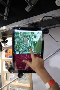
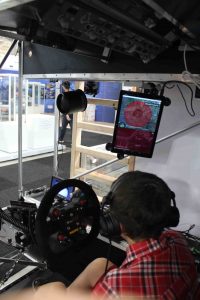
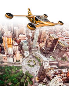
We understand the unique challenges faced by pilots of aircraft, helicopters, and drones navigating the increasingly crowded skies of urban environments. That’s why we’ve developed PrivateBee, a state-of-the-art GPS navigation system designed specifically for urban air mobility. PrivateBee is not just a tool; it’s your trusted co-pilot in the complex airspace of cities.
Features of PrivateBee
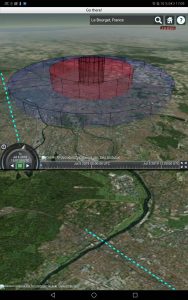
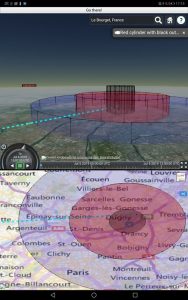
Advanced Navigation: PrivateBee offers precision routing and real-time traffic updates for air routes, helping you avoid no-fly zones, restricted areas, and unexpected air traffic congestion.
3D Mapping Technology: Utilizing cutting-edge 3D mapping, PrivateBee provides a comprehensive view of urban landscapes, including skyscrapers, communication towers, and other critical landmarks for safer navigation.
Seamless Integration: Easily integrates with a wide range of aircraft, helicopters, and drones, ensuring that regardless of your air vehicle, you have the most reliable and accurate navigation at your fingertips.
User-Friendly Interface: Designed with the pilot in mind, PrivateBee features an intuitive interface that simplifies complex flight data, making it accessible for both professional and recreational aviators.
Applications of PrivateBee
Commercial Aviation: Enhance safety and efficiency in route management for charter flights and air taxis operating within or between cities.
Emergency Services: Provide rapid and precise routing for air ambulances and law enforcement agencies, reducing response times in critical situations.
Recreational Flying: Offers hobbyists and drone enthusiasts the ability to explore the urban airspace safely, with guidance that keeps them clear of restricted zones.
Why Choose PrivateBee?
Reliability: Engineered for accuracy and dependability, PrivateBee lets you navigate urban skies with confidence.
Innovation: At the forefront of GPS technology, PrivateBee incorporates the latest advancements in geo-positioning for air travel.
Support: Our dedicated support team is available to help with any questions or integration needs, ensuring you get the most out of your PrivateBee experience
Join the Urban Air Mobility Revolution
Urban airspaces are becoming busier and more complex by the day. With PrivateBee, embrace the future of urban air mobility with technology that offers you security, efficiency, and the freedom to fly safely in urban environments.
Contact Us
Have questions or need assistance with your PrivateBee system? Our expert team is ready to help. Visit our Contact Page for more information, or reach out directly through our customer support portal.
Stay Informed
Stay up-to-date with the latest developments in urban air mobility and GPS technology by visiting our Wiki and CollaborativeBee platforms. Participate in discussions, read articles, and connect with other aviation professionals.
